Search This Blog

Where is TIDES INN Today?

Click here map link
The last position reports for Tides Inn will be displayed on the map. (Courtesy of www.winlink.org) Tides Inn homeport is Dare Marina, Yorktown VA

Back to Nassau 28-29 Mar


   We had decided to head back between the Majors as the most comfortable anchorage for the cold front and were heading towards the Bank when it dawned on me - with southwest winds, why not sail back to Nassau and sit out the frontal passage anchored at Montague just like we had done twice before with Jackson.  So, we made a right turn instead of left and set sail for Nassau.

  This was easily our best sail of the entire trip. The wind was steady all day from the southwest at 15kts giving us a beam reach to Nassau. Even with our tardy departure from Compass Cay, we were in Nassau in 11 hours, averaging over 6kts, and safely anchored before the front came through (at midnight of course). 

  Interestingly, when the wind shifted and gusted a sailboat ahead of us broke free and dragged his anchor. He came up against a boat beside us and they sorted it all out in the dark and blowing winds. Boat that drag almost always don't have enough anchor scope out. We had no problems with our 150ft of chain out. 


   Anchored back in Montague Bay with northeast winds after the frontal passage. We will stay here until Sunday when the weather looks good for transiting back to Florida. A bit bumpy here but not bad. 

Compass Cay - Rachels Bubble Bath 27 Mar


   The winds are light so we decided to come check out the anchorage up by Rachels Bubble Bath. It is a bit tricky getting in here and not a safe anchorage for any strong winds with its reversing tidal currents but the winds are fairly calm. 

  We explored along the beach and rocks, not much different from the other island beaches. 


   We decided to skip the Bubble Bath as the winds were light (so not many bubbles) and there were lots of tourists there. Just a stroll along the beach with Rivah. Sue found a few large old conch shells to add to her collection. 


   Sunset from our Compass Cay anchorage. The clouds over Andros are always there. 

  Tomorrow we have to go hide for the next cold front. Still trying to decide if we should go north to Bell Cay or need to go back between the Majors. I hate to go back south but it is the more comfortable anchorage for the forecasted winds. 

Big Majors 23-26 Mar


   With the wind back to the southeast, we came back to the main Big Majors anchorage area. No sense heading further south as we learned about the uncomfortable southern swell off Bitter Guana Cay and we will be starting our way back north on the 27th, so we will sit here for a couple days enjoying the sun and water. 


   We were out touring around in our dinghy checking out the beaches and saw this large ray that swam under the dinghy. 

   Later in the day we watched a large nurse shark swim under our big boat but couldn't get a camera soon enough. 

   You have to get south to the Exumas to get water this crystal clear. Even in Nassau it is very green and not as easy to see the bottom. Not too much different than Florida. 


   Now this was impressive. When the space launches leave Cape Canaveral just after sunset, the sun lights up the contrail in spectacular fashion. It is fairly dark where we are anchored but, the sun is shining up in the atmosphere by the rocket.  This is a Starlink satellite launch.

   We were able to watch it for a long time and able to see the burn of the booster coming back down to land. 


   Still going as the second stage burns crossing in front of our boat. It is actually quite dark on our boat but the camera makes it look like daytime. Very cool.


Our last sunset at Big Majors. Tomorrow we will start heading north, first up to Compass Cay then somewhere, maybe Bell Cay, to hide out for the next cold front passage. These cold fronts are starting to be a pain as they keep coming through every 6 days. 

Of note, this sunset was actually just before the Starlink launch.

Back between the Majors - 22 Mar


   Back between the Majors for the next Cold Front passage. We are a bit further south than last time, further away from the gaggle of boats to the north but more exposed to the opening to the East. Not many other boats anchor here as it is exposed to swells coming in from the East, but there shouldn't be any wind or big waves coming from that direction. This front isn't supposed to be as strong as the last one. 

   By the time it got dark, another 5-6 boats had joined us here but all are keeping a safe distance. Not like up north.

     Fortunately, no strong thunderstorms with this front, only rain and wind shift. You can see on our chartplotter how the boat swings around the anchor with the wind shifting and the tidal currents flowing through each 6 hours.  For awhile with the west winds we were being blown over close to those rocks to the east, but once the wind shifted to the north we were safe hanging down to the south.  We did experience an uncomfortable swell coming in the inlet from the east, but not unsafe. But, we made an early exit the next morning.

Blackpoint - Sand Castle Anchorage - 19-21 Mar


   The cold front has blown through and we can move back to the bank side of the Exumas. With the strong northeast winds forecast for the next couple days we have moved to the south side of Blackpoint. There is a beautiful sandy beach here, not many boats and easy 1.5 mile walk into town.


   First on the list of chores as we walk towards town is to carry the garbage to the island dump. Most of the island marinas will take your trash for $5 a bag but, Blackpoint has a dump along the way to town so we can drop it off ourselves along the way.


   Almost to town. We walked in twice today, first to drop the trash and take Rivah for a walk, then to head into town for happy hour without the dog and check out the beaches on the Sound side. Total of 8 miles for the day which made Sue happy.


   The old Scorpios is now the Blackpoint Yacht Club with a bright new restaurant building right on the water. They have two docks for small boats to come tie up and we watched a parade of "tour boats" bringing tourists in for lunch. They come from both Nassau and Georgetown by high speed boats (both places are 50nm away so a couple hour drive for the speed boats). The beer and appetizers were excellent - of course at "island prices". 


   Back to the dinghy after our touring. The tide has gone out on this relatively flat beach so it will be a bit of a heft to drag it back to the water. Not a big problem. 


   Walking over to the Sound side of the island the shore is rocks and cliffs and dead coral, just like all the other islands in the Exuma chain. 


   There is a blow hole on Blackpoint where the water comes through underwater caves the spouts up like a geyser. On a very windy day the water goes up 15-20ft high like a real geyser. Today it wasn't so windy and just a few big splashes. Sue spent a good deal of time trying to get an impressive photo without much luck. Thank goodness for digital cameras and ability to easily delete a large number of failed photos.


   Not very many shells but Sue is always looking for treasures. Lots of plastic of course. I did find several pieces of sea glass.


   Next day it is back to the Yacht Club for beers and appetizers. Can't beat the view and atmosphere.  This is life in the Bahamas. 


 Another pretty sunset but no "green flashes" in the Exumas. There are always clouds over the island of Andros, 50 miles to the west, that block the view of the sun setting into the ocean. 

   Its been a nice visit to Blackpoint but the next cold front is on its way. Tomorrow we have to make our way back to the safe anchorage between the Majors. 

"Between the Majors" 18-Mar

    One advantage of having Jackson visit us in the Bahamas was that it required us to be near Nassau and enabled us to take advantage of Providence Island marina and anchorage protection for two weather cold front passages. 

   Now we are in the Exumas and have to find a place to anchor with protection from the strong westerly and northwesterly winds coming tonight.  There are only a few of these spots and lots of boats come to anchor in the same protected waters. This spot is between Big Major and Little Major islands. To get here you have to pass through some very narrow channels with strong currents and rocky reefs on both sides. We normally don't come over here but must for the strong cold front coming through. 


      The rain has started and will continue through midnight when the winds will shift to the north.

   A few hours later a strong thunderstorm came through with winds 40-60kts. At least one boat dragged its anchor. Surprisingly, several boats had their dinghies still in the water and the strong gusts flipped them over. Everyone was looking for cushions and other gear the next morning and having to fresh water rinse their motors. We had no problems, just a sleepless night.


   Sitting at anchor in the rain, time to play some games. Sue and I learned this game called "Trash" that is easy and fun to play, not requiring much strategy or card sense (or counting cards). 

Jack's Bay -17 Mar


   Up from White Point is a small indentation called Jack's Bay. It is too shallow to take the big boat into but you can dinghy into the Bay, being careful to pass in between the rocks and reefs coming out from both sides of the entrance.


   Looking into Jack's Bay. We had this anchorage spot all to ourselves also. 


   Obviously plenty of cruisers have stopped by this site. 


   Tides Inn sitting off Jack's Bay. You can't anchor too close into shore here either as there is a rocky reef running just outside the bay.

   The wind and waves were down but the southerly swell was still rolling along the coast making the anchorage a bit uncomfortable.


 Taking advantage of the benches set up we brought in some drinks and snacks for happy hour and our mini solo stove.


   These are the days that make the long trek to the Bahamas and down to the Exumas worth the effort and stress. Nothing like a cold beer and chips around the fire on a tropical island.


   Jack's Bay was a great stop but the weather was always a factor throughout our stay in the Exumas. The next cold front was coming through with strong west and northwest winds so it was time to find a protected spot. The closest to us is just north "between the Majors". This is a fairly narrow channel between Big and Little Major where there is good protection from westerly winds.

White Point - 16 Mar


   With the winds shifting to the southeast and building we were experiencing and uncomfortable rolling from the swell coming up the island shore.

   We moved up and behind White Point to get protection from the southern swell. It helped but wasn't all that successful as the swell just wrapped around White Point.

   Meanwhile, there is a wonderful beach at White Point that we only shared with one other boat.


   Half the shoreline was beach and the other half was flat rocks and dead coral. No shells or sealife to see.


   Its obviously a popular beach for cruisers to visit although not a place to loiter for many days, I expect because of the southern swell that prevails on most days here.

  The island is too wide at this point to walk over to the Sound side so there is just the western shore to explore.


   A view of Tides Inn anchored off the White Point shore. You can't get too close to shore to anchor here as it gets too shallow quickly.  

   There was only one other boat up to the left of us who didn't go ashore so we basically had the beach to ourselves.

   All has been going fine mechanically with Tides Inn until today when we heard the bilge pump go on. That's not good. 

  A quick check of the engine compartment - full of water!  I had a good idea what was the issue, had to be a leak in the cooling water system. After unloading the back room so we can get access to the engine, yes a clamp had broken on the hose to the oil cooler.

   We replaced the clamp and problem solved. I noted that the clamp broke because it was corroded by a slow leak around the oil cooler. We'll have to replace that upon return to Yorktown but for now, 2 clamps and some JB weld epoxy fixed the issue.  Cruising is really boat maintenance in exotic locations, as they say.


     One last walk on the beach then it was time to move up the Cay further to Jack's Bay. 

Oven Rock - 14-16 Mar


   Heading down the bank side of Bitter Guana. This is the Bahamas Exuma Bank sailing we have been seeking. Easterly tradewinds and total protection from the ocean waves. Its only a couple hour trip down to Oven Rock near the southern end of Bitter Guana, near Farmers Cay. 


   Here's Oven Rock. I guess it is supposed to remind one of an outdoor pizza oven. You can walk out to the rock from the shore side but there's not much to see except rock and old dead coral. Not much sealife around the rock and dead coral.


   The main attraction at Oven Rock is the large cave with an underground brackish water pool that some brave folks actually swim in.

   The path to the cave it not hard to find - well marked out by previous cruisers.


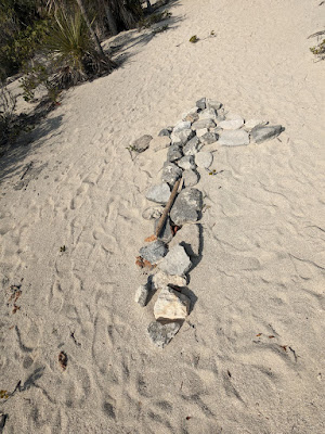
   Follow the makeshift signs and you'll get there.


   There actually is one trail fork that you can miss. The trail also heads over to the Sound side of the island and you have to take the right fork to head up the hill to the cave. Its easy to miss with no blatant "finger" sign pointing the way.


  We didn't miss the turn and soon were arriving at the cave entrance.

   It actually is a pretty impressive cave. This is the primary chamber but it continues to wrap around a large rocky mound on the left and the water encircles the mound.

   As I said, some brave (foolhardy) souls swim in this water but we skipped it. It is actually much darker than the photos show as our Google phone cameras are collecting all the available light.  We are only seeing what our small flashlights light up.


    The stalactites and stalagmites were also impressive. There is a lot of water from the frequent heavy showers in the Bahamas that seeps down from overhead through the limestone rocks. It has not rained in over 5 days but there were still numerous drips in the cave building up new structures.


 One final selfie then off to the shore on the Sound side.


   Very similar to the Sound shore up at Iguana Beach, this shore is barren rocks and dead coral (and plastic) with braking waves coming in from the east.


   After a day of exploring, time to watch the sunset from the beach.

Bitter Guana - Land of the Iguanas 13-14 Mar


    Bitter Guana Cay is home to a large number of iguanas which are protected and, are well fed by visiting cruisers and increasingly tourists being shuttled down from Nassau or from the mega-mega yachts (250ft and larger) that anchor off the islands. 

   The iguanas spend most of their day laying in the shade under the scrub bushes but they come running out to greet any folks on the beach, expecting to be fed.


    At the end of the beach is a small cove which was full of iguanas escaping out of the bright and hot sun. These guys must have already eaten today as they ignored us and stayed in the cool shade.


   Bitter Guana is a narrow island and it is only a short walk over to the eastern shore that borders the Exuma Sound. This is the shore facing the prevailing easterly tradewinds and is normally quite rough. Generally no anchoring on this side. Its also generally quite rocky and covered in old dead coral reefs.


   The Sound side often has these inlets amongst the rocks and reefs. Very picturesque and presents the opportunity to shift through the wave and wind driven debris for treasures. 

   There were lots of little shells, good for decorating woven baskets but, also lots and lots of plastic coming over from Eluthera Cay to the east.


   Back to the boat sitting placidly in the protected bank site of Bitter Guana. Tomorrow we are off further south to Oven Rock.