Search This Blog

Where is TIDES INN Today?

Click here map link
The last position reports for Tides Inn will be displayed in red on the map. (Courtesy of www.winlink.org) Be sure to check the date for the latest position, our last year's journey is also displayed. Tides Inn homeport is Dare Marina, Yorktown VA

Holden Beach 23 Apr

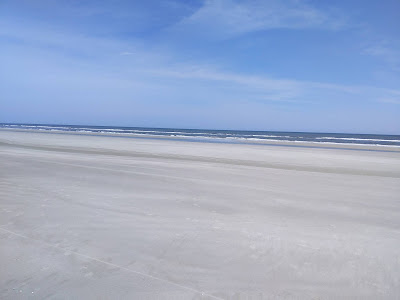
        Our transit from Calabash to Holden Beach was uneventful as the Shallotte Inlet section was dredged over the winter since our passage southbound in Jan. On the way south we saw less than 6ft of water (our draft is 5ft), but now it was all over 12ft deep. The weather continued to be great for our arrival at the beach. But a storm was forecasted for the evening. 


There were lots of shells to pick through as we walked a couple miles up the beach to the Lockwoods Folly inlet, another shallow spot on the ICW, but also dredged while we were in Florida. 


 There were lots of smells for Rivah to check out along the high tide line. While it was sunny with blue skies, the northwest wind was quite cool.


   By the end of the day, Sue had another large collection of shells to transport back to Yorktown. 


   That night a storm blew through with heavy surf crashing on the beach. Before departing the next morning we walked over to the beach to check what had washed up over the night, but the tide was still so high that there was little to see but sand and foam.

   It was time to get underway soon as we needed to get through the next shallow water spot, Snow's Cut, before low tide. That area has still not been dredged. We got there a couple hours before low tide and passed through with no problem although we did see about 6 ft right at the entrance to the cut by Carolina Beach. 

Charleston - Holden Beach Through Waccamaw River 19-22 Apr

   After Charleston, our next planned stop was at Holden Beach, NC, where Sue loves to walk the beach and pickup sea shells. We confirmed again on this long trip to Florida that Holden Beach is one of the best shelling beachs on the East Coast, probably because the beach runs on an East-West axis rather than North-South as most beaches do on the East Coast. 

   It is possible to run offshore from Charleston up to North Carolina with several places to pull back into the ICW there, however, the weather continued to not cooperate presenting us with north winds. At least the skies were sunny though. 

   The advantage of the ICW through this area is that it is one of the prettiest sections of the ICW, winding up through the Waccamaw River.


   The first leg of the 3 day trip passes through a canal section from Charleston to the Waccamaw River up near Georgetown. There is a great anchorage area halfway up the canal on Awendaw Creek heading out to the ocean. We have anchored here many times and enjoyed some ideal conditions again on this trip.


   A new issue that we encountered anchoring in Georgia and South Carolina, I expect associated with the timing of our transit, was that every morning I would have to clean the "bugs" out of our speedometer unit. These bugs are not as big as they look in the photo, there would be 20-30 of them packed into the speedometer housing with its paddlewheel that sticks out the hull into the passing water. This space is less than a half inch wide and one inch deep. Every night for about a week, they would be packed in there, I suppose for safety from other predators. Some of them were baby shrimps and others were these guys.


North of Georgetown you enter the scenic section of the Waccamaw winding its way up towards Myrtle Beach. It is a beautiful river bordered by cypress and pine trees with scattered sweetgums.


   In the Waccamaw we normally anchor in Cowhouse Creek off of Wacca Wache, just south of Myrtle Beach. 

   This time of year there were noisy airboat tours and lots of recreation boats cutting through the Creek, but all that traffic stops at sunset. 


An airboat tour coming through. We could hear these guys winding their way through the small creeks, behing the trees, surrounding us.


   The third night before arriving at Holden beach, we stop at our frequent anchorage at Calabash Creek along the SC/NC border at Calabash. The creek is actually much narrower than it looks in this photo. There is just a little bit of room between the shore and the channel where lots of fishing boats pass transiting between the ocean inlet and marinas up the creek. 

Our great weather continued to hold, although the cold north winds also continued.


Charleston 17-18 Apr

    From Port Royal, just up from Hilton Head, its two days by boat to Charleston through the SC grasslands and shallow waters, but this trip we were traveling during mid to high tides. We anchored up in Oyster House Creek on the 17th. Initially, it was quite windy and a bit rough as there is little protection from the wind and waves in the grasslands, but the wind settled down some during the night. The next morning we were off to Charleston and made good time arriving off the peninsula with the historic waterfront homes just after noon.


   We had hoped to stay at the Charleston Maritime Center marina but found out that most all the Charleston marinas were fully booked. We found a spot up the Cooper River at the Cooper River city marina. While it is in a fairly industrial area between two merchant ship unloading facilities, the marina folks and services were excellent. Since we were leaving early the next morning they let us tie up on the end of the T-head rather than in a narrow slip. Given the tidal currents in this marina, that was just great.


   While in Charleston we were able to meet with our good friends, Paulette and Tim. Paulette was our best friend from high school days and Sue's maid of honor at our wedding. We had a great visit and wonderful dinner at a waterside restaurant. I scoped out the anchoring spots much closer to the restaurant, as they told us it was one of their favorites. Next trip we will know where to go and anchor nearby. 

Next morning it was time to push off and continue the journey northward. Charleston is just as busy a harbor as Savannah and we had to race this guy to see who would get through the bridge first. We made it through with plenty of time to move over a bit to the right and give him space to pass. 

Kilkenny to Port Royal - 16 Apr

       One unique feature of the Kilenny marina is that it is the location where all the local egrets come to roost at night. By sunset there were at least 50 white egrets sitting in the trees along the river bank. After a bit of prehistoric squawking they all settled down for the night.

   With 8ft tides it is quite difficult and expensive to build a safe boat launch ramp so, the locals have come up with an alternative launching method. With 2 straps, it is a quick process to lift a boat off the trailer and into the creek.  


A new 65ft bridge is under construction at Causton Bluff, GA, and can't come soon enough. The existing bascule bridge only opens on one side these days. One of the tightest fits along the journey.

   The last time we came through this section of the ICW was in 2006 at dead low tide and we got stuck in the mud in mid-channel trying to get up to the bridge. We had to tell the bridge tender it might be 30-60mins before we could get to the bridge waiting for a couple inches of tide to come in.   This trip we went through at near high tide and had an extra 8ft of water depth.


   With our new chart plotter and AIS transponder it significantly increases safety helping keep everyone aware of traffic conditions. Here we are approaching and crossing the Savannah River, which is a busy merchant shipping lane. Sure enough, there was a container ship coming down the river on a collision course with our crossing. Not only can I see on my plotter where our intersection is going to be on present course and speed, the merchant ship has the same picture showing my position and course/speed which is broadcasted by my AIS device.  I only had to slow down and pass behind him, which he could monitor on his plotter. 

What you cant see on this photo is that there is a dredge and two tugs working on the other side of the river, right along the ICW route to the north. Again, the plotter shows the exact position of all the vessels and the safe route around them through deep water.


   And here comes the container ship, emerging from behind the trees. Unlike our 2006 trip through here without a chart plotter, this time I knew he was coming and that I should slow down and safely pass behind him and not try to race him across. Interestingly, he never called me on the radio to check my intentions (or tell me to hold position) as they often do in the Chesapeake. I expect that was because he could see from my AIS what my plans were.


   The weather was good and we were making good time so we decided to press on until sunset and made it to Port Royal, anchoring just off the Marines Base at Paris Island. We got to listen to the Marines morning PT sessions starting at 0500 am.

Georgia - South Carolina grasslands - 14-15 Apr

    Normally, we try to avoid transiting the ICW through Georgia and South Carolina south of Charleston because of several factors: it is miles and miles of meandering and winding rivers and canals through completely flat grasslands and marshes, there are 6-8 foot tides which result in very shallow sections at low tides which are basically unpassable and challenging to anchor at night, and basically, it takes 3 days to get from Brunswick to Charleston via the ICW which can be done in under 24hrs transiting offshore. However, to make the offshore 24hr passage, one needs the right wind and sea conditions and Mother Nature was just not cooperating with us. Add to the uncooperative weather forecasts, our experience throughout this journey south and back was that the weather was never exactly as predicted so we were not keen to head out into questionable conditions. Besides, we are retired and not on any schedule, so why not take the slow but safe and picturesque route through the grasslands.


     This is the view basically for 3 days between Brunswick and Charleston. One interesting result is that when you see approaching boats that are also winding their ways among the grasslands, they appear to be sailing across the grasslands as all you see are the approaching masts and superstructures out in the marshes until they finally make it to just in front or behind you.  

   We were a little surprised to see a large cruise boat come past us in the Georgia ICW given the many very shallow spots. But it turns out that American Cruise Lines runs weekly cruises between Charleston and Jacksonville through the ICW, apparently paying close attention to the 8ft tides and picking their transit times appropriately.    We got this picture while we were at anchor up one of the creeks feeding into the ICW. The wind was brisk but there was enough protection to not cause too much rocking and rolling.


   As sunset arrived, the wind normally dies down some and we were able to enjoy a comfortable cocktail hour.


   The next day it is more of the grasslands. But the one advantage of the ICW is there are always more sights to see than 24hrs of open ocean waves. We motored past a pair of bald eagles sitting on a convenient navigation marker.

  Tonight we decided to pull into Kilkenny marina, which has the lowest price for diesel fuel south of North Carolina, about $1 a gallon lower than most other marinas in the area. Of course, the low fuel price is the main incentive to get you to stop here, there is not much else going on in Kilkenny. We went for a nice several mile hike outside the marina and noted one or two passing cars during the hour long walk. There is an upscale seafood restaurant next door to the marina but without outside seating so we passed during these COVID times.


Capsized MV Golden Ray

    Just north of Jekyl Island in the St Simons Inlet separating Jekyl from St Simons Island is the site of the capsized car carrier MV Golden Ray. The ship capsized back in October 2019 and removal efforts are still underway with a little over half of the ship removed. The two large yellow circular structures are the mechanisms that hold the "chain-saws" that are used to cut the hull into sections that can be removed onto barges and taken away.    


    As a certified US Coast Guard Master and experienced sailor, I wondered how a ship under the guidance of a qualified port captain could run aground and capsize in the wide and well marked channel. I read the accident report and learned the sequence of bad luck that resulted in the disaster. Turns out the ship had a fire onboard which caused it to lose propulsion. The onboard harbor pilot decided that the best course of action was to ground the ship outside the channel so that the busy channel would not be blocked. Unfortunately, the ship went aground onto a very steep edge of the channel and in so doing it heeled excessively to port - the onboard load of cars shifted to the low side causing a further heel to port and the ship ultimately capsized onto its port side, fortunately, out of the main channel, which was the Pilot's objective.  Salvage operations continue 18 months later.


Jekyl Island, GA 12-14 Apr

    Our next stop was an anchorage just off the ICW along Jekyl Island. While there are only a very few private residences on Cumberland Island, Jekyl has a fairly large permanent residents plus winter snowbirds and tourists.  The weather was fine so we decided to spend a couple days touring around. The first day we landed at a public boat launch and spent the day walking along the trails and into town for a cool drink. The second day we landed at the main island marina and paid the nominal landing fee which provided us access to their laundry room, showers, and rental bicycles. 


   We spent most of the day riding around just about the whole island. The most spectacular area was the "driftwood beach" section where rising sea levels have drowned a great number of Live Oak trees leaving picturesque skeletons behind. For some reason these dead, bleached and scraggly tree remains are a very powerful emotional site. For those who don't believe in climate change and rising sea levels, you need to get out of your comfortable denial chair and see what is happening in the real world.


   From the beach we rode back down to "town" which basically consists of two blocks of cafe's and tourist shops alongside a center grassy mall. We had a Starbucks iced coffee and relaxed in the comfortable chairs and great weather.


   That evening was a "deja vu" of our visit to Jekyl Island in 2005 on our first trip down the ICW, when we sat on the deck of the Jekyl Island marina restaurant and ate steamed shrimp as we watched the sunset. 

   This visit it was long after sunset when we were finally seated at the restaurant (because of COVID they are understaffed and only seating half their tables), but the seafood was still excellent and, except for the no-seeums, the evening was grand.

  After a couple enjoyable days, it was time to move on north once again.


Cumberland Island, GA 9-11 Apr

     We're back off Cumberland Island and this time the weather is suitable for going ashore and exploring.  Most of the island is heavily forested by old Live Oak trees that can thrive in the sandy salty near ocean soils. Half of the island is a national park and there are several trails you can walk through, including a couple trails over to the ocean beach.

   We are anchored off the western shore of the island in a narrow stretch of water between the ICW and the main island. This visit we anchored farther to the north to try to get some better protection from westerly winds and seas. I'll show you a picture of the weather below so you understand why.


   The main attraction of Cumberland Island for Sue is the beaches and seashells to pick through. Turned out there weren't a great number of shells but there were some unique ones. 


   We found this Pen shell in good condition and unoccupied by any marine critters. 


   Cumberland Island was the site of the winter residence of Andrew Carnegie's younger brother Thomas and his wife Lucy and their 9 children. Thomas died shortly after the mansion was built but Lucy and her children spent many winters on the island. The mansion was ravaged by a fire in 1959 and only a stone skeleton remains.


   Life on a boat is always being aware of the weather and marine conditions. Frontal systems with intense squall lines come through the southern states on a 7-10 day cycle during the winter and spring months. This storm blew hard for a couple hours then it was just scattered showers throughout the night. We were a bit more comfortable in our anchorage farther to the north compared to the winds and seas we experienced anchored further south on our way down to Florida.


   We stayed a couple days at Cumberland Island enjoying the sunny days before and after the rain showers. Rivah had a good time chasing her frisbee ring on the beach. 

   But soon it was time to keep heading north, up to the next island along the Georgia shoreline, Jekyl Island.